Ready to improve your Disaster Relief systems? Contact Us
Ready to improve your Disaster Relief systems? Contact Us
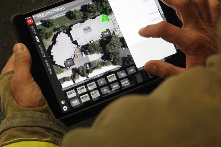
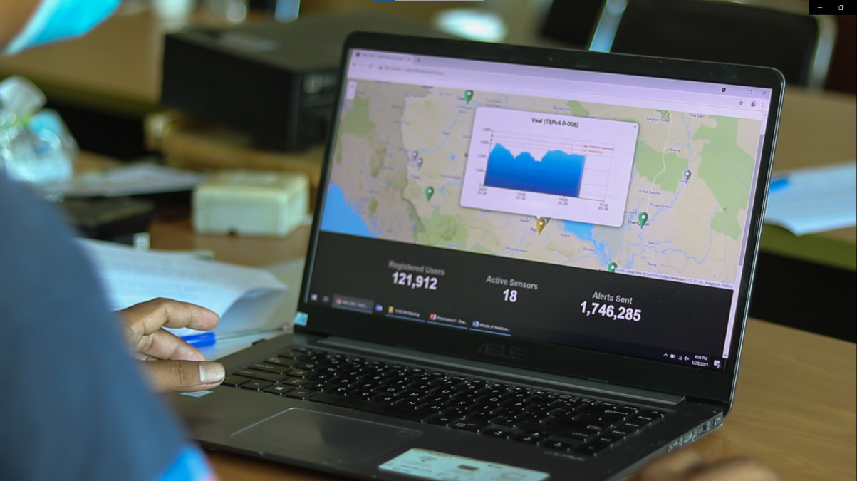
Wildfires move fast. Your response systems should move faster. Interlinked delivers a suite of web-based tools and integrations designed to support dispatchers, incident commanders, and frontline teams. By pulling in real-time sensor, satellite, and terrain data, we generate predictive spread models that help you anticipate direction, intensity, and speed.
Use our dashboards to:

Monitor real-time fireline changes to adjust field tactics instantly.

Get notified when winds drive fire toward new hazards.

Detect terrain and access issues before they delay crews.

Update evacuation plans every 60 seconds with live spread data.
Our API-first design makes it easy to plug Interlinked into existing dispatch platforms or use it as a standalone tactical tool during major events.
Whether you're a municipal fire department, a state agency, or a regional EOC, Interlinked can operate as a standalone interface or be embedded into your command center environment. No GIS expertise needed. We designed our tools to work with minimal setup and zero delays.
Map upload or area selection
Real-time feeds begin streaming
Wind and terrain overlays activated
View min-to-min fire movement
Set alert thresholds
Share visual outputs with teams
Enhance your existing information systems and Benefit from improved response and preperatory technology
