Ready to improve your Disaster Relief systems? Contact Us
Ready to improve your Disaster Relief systems? Contact Us
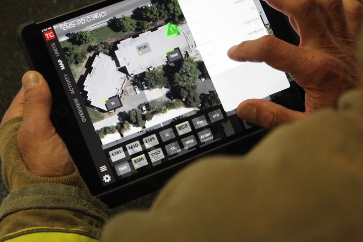
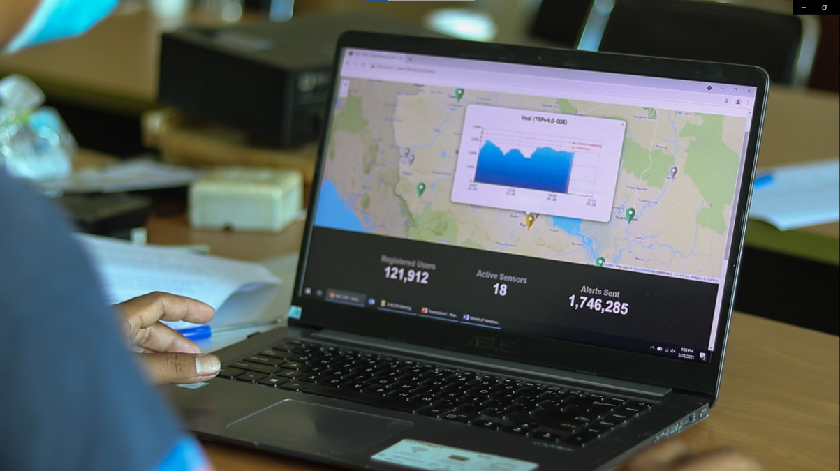
Wildfire risk isn’t static — and neither should your planning be. Interlinked’s tools offer continuously updated, high-resolution insights across exposure zones, helping you validate assumptions and identify where support or coverage should be prioritized. Our interface combines satellite intelligence, land cover, historical fire patterns, and weather projections to power smarter pre-incident decisions and portfolio-wide oversight.
Use our dashboards to:

Identify assets and communities most at risk with dynamic hazard overlays. (Think: risk mapping tools for insurers, planners, utility managers.)

Simulate potential fire paths based on terrain, wind, and historical ignition data.

Highlight gaps in mitigation, access, and emergency coverage to target investment.

Analyse seasonal and weather-driven changes to update risk models in near-real time.
Our API-first design allows you to pull Interlinked’s risk data into your internal underwriting models, GIS tools, or planning dashboards — building wildfire intelligence directly into your business logic.
Whether you're pricing insurance, issuing a disaster bond, setting policy boundaries, or allocating mitigation funding, Interlinked’s tools give you the geographic and predictive intelligence to make decisions with confidence. Minimal setup. No GIS expertise needed. Continuous updates built in.
Upload boundary files/ select templates
Historical fire and exposure overlays
Parcel, vegetation, and proximity data
Visualize risk zones and exposure
Compare conditions across assets/ time
Integrate risk insights into internal GIS
Enhance your existing information systems and Benefit from improved response and preperatory technology
